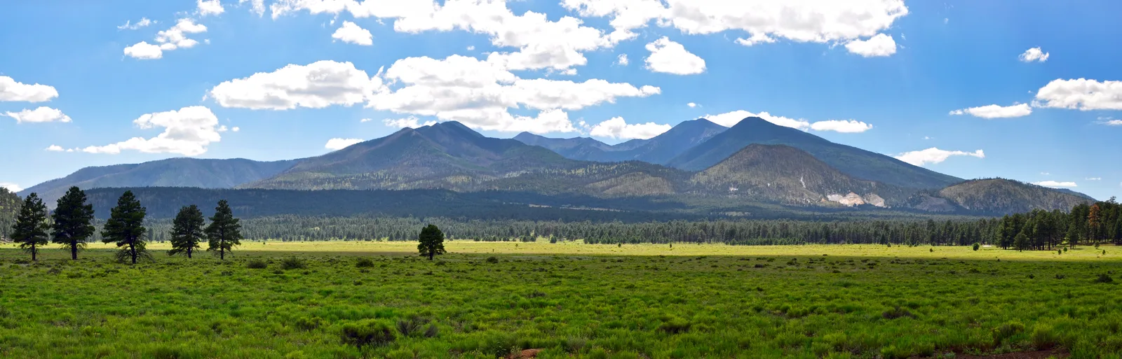
Photo: Coconino National Forest, CC BY-SA 2.0, via Wikimedia Commons
trail running
Flagstaff Crest 40 · Cocodona 2027
The final 40 miles of the Cocodona course, Fort Tuthill County Park to Heritage Square on the Flagstaff Urban Trail System and the Arizona Trail, inside 27 hours.
Start Line - Flag…M08.6 - Bow and A…M15.0 - Sinclair …M23.8 - Woody Mou…M28.4 - FACFinish - Heritage…
The biggest climbs
Starts at
Length
Gain
Average grade
29.1 mi / 46.8 km
1.4 mi / 2.2 km
387 ft / 118 m
5.3%
10.2 mi / 16.5 km
0.8 mi / 1.3 km
167 ft / 51 m
3.9%
33.3 mi / 53.6 km
0.6 mi / 0.9 km
125 ft / 38 m
4.1%
15.1 mi / 24.3 km
0.3 mi / 0.5 km
95 ft / 29 m
5.5%
34.3 mi / 55.2 km
0.3 mi / 0.4 km
92 ft / 28 m
6.2%
16.1 mi / 25.9 km
0.3 mi / 0.4 km
66 ft / 20 m
4.9%
The biggest descents
Starts at
Length
Drop
Average grade
36.2 mi / 58.3 km
1.0 mi / 1.7 km
292 ft / 89 m
5.3%
30.5 mi / 49.2 km
0.6 mi / 1.0 km
187 ft / 57 m
5.7%
6.2 mi / 9.9 km
0.7 mi / 1.2 km
144 ft / 44 m
3.8%
26.5 mi / 42.6 km
0.5 mi / 0.8 km
92 ft / 28 m
3.6%
37.4 mi / 60.2 km
0.4 mi / 0.6 km
85 ft / 26 m
4.1%
8.4 mi / 13.5 km
0.1 mi / 0.2 km
79 ft / 24 m
11.1%
Points on the course
Start Line - Flagstaff Crest 40 at 0.0 mi / 0.0 km, +0 ft −0 ft so far
M08.6 - Bow and Arrow at 8.6 mi / 13.8 km, +322 ft −515 ft so far
M15.0 - Sinclair Wash at 14.9 mi / 24.0 km, +643 ft −692 ft so far
M23.8 - Woody Mountain at 23.7 mi / 38.2 km, +1,040 ft −997 ft so far
M28.4 - FAC at 28.4 mi / 45.7 km, +1,194 ft −1,220 ft so far
Finish - Heritage Square at 39.9 mi / 64.2 km, +2,028 ft −2,110 ft so far
Derived from the course file (40-mile.gpx) analyzed Nov 6, 2026, not official race statistics. The file carried no elevation, so the heights come from a terrain model sampled along the course (AWS Terrain Tiles by Mapzen; 3DEP and SRTM terrain data courtesy of the U.S. Geological Survey, EU-DEM from Copernicus) — a smoother profile than a watch records. Official elevation gain 3,212 ft / 979 m, loss 3,336 ft / 1,017 m.
average during the 08:00–12:00 race hours at Flagstaff, 5 years
The venue through the year
J
F
M
A
57 °FM
J
J
A
S
O
N
D
Over the last 5 years, the 08:00–12:00 race hours at Flagstaff averaged 14.6 °C (58.3 °F) across the 7 days either side of May 6, 2027's calendar day.
From the Open-Meteo weather archive at the venue; an average over 5 years and a 7-day window, not a forecast.
The numbers for your goal
39.9 mi / 64.2 km inside 27 hours: a cutoff is the latest you may leave a station, and the organizer's schedule — tight early, looser late — is the shape of the race; pick a finish and the legs below are that schedule scaled to it.
Cutoff
27 hours
Average pace at the cutoff
40:36 /mi / 25:14 /km
Tightest checkpoint
Sinclair Wash · 28:00 /mi / 17:24 /km(15.0 mi from the start, leave by Day 1, 14:00)
Tightest leg
Bow and Arrow → Sinclair Wash · 23:26 /mi / 14:34 /km(6.4 mi in 2:30)
Climb per mile
51 ft/mi / 10 m/km
Descent per mile
53 ft/mi / 10 m/km
Finish
Average pace
Least time in hand
13:00
19:33 /mi / 12:09 /km
+2:20 at Bow and Arrow
16:00
24:04 /mi / 14:57 /km
+1:50 at Bow and Arrow
18:00
27:04 /mi / 16:49 /km
+1:30 at Bow and Arrow
21:00
31:35 /mi / 19:37 /km
+1:00 at Bow and Arrow
24:00
36:05 /mi / 22:26 /km
+0:30 at Bow and Arrow
27:00 (cutoff)
40:36 /mi / 25:14 /km
none — leave every station as it closes
Average pace 27:04 /mi / 16:49 /km on the organizer's cutoff schedule with no stops planned. Type minutes in the Stop column to see the moving pace that finish needs.
Section
Length
Climb
Descent
At
Arrive
Clock
Stop
Leave by
Buffer
Start → Start Line - Flagstaff Crest 40
0.0 mi / 0.0 km
0 ft / 0 m
0 ft / 0 m
0.0 mi / 0.0 km
0:00
Day 1, 07:00
—
—
Start Line - Flagstaff Crest 40 → M08.6 - Bow and Arrow
8.6 mi / 13.8 km
322 ft / 98 m
515 ft / 157 m
8.6 mi / 13.8 km
3:00
Day 1, 10:00
Day 1, 11:30
+1:30
M08.6 - Bow and Arrow → M15.0 - Sinclair Wash
6.4 mi / 10.3 km
322 ft / 98 m
177 ft / 54 m
14.9 mi / 24.0 km
4:40
Day 1, 11:40
Day 1, 14:00
+2:20
M15.0 - Sinclair Wash → M23.8 - Woody Mountain
8.8 mi / 14.2 km
397 ft / 121 m
305 ft / 93 m
23.7 mi / 38.2 km
7:40
Day 1, 14:40
Day 1, 18:30
+3:50
M23.8 - Woody Mountain → M28.4 - FAC
4.6 mi / 7.5 km
154 ft / 47 m
223 ft / 68 m
28.4 mi / 45.7 km
10:00
Day 1, 17:00
Day 1, 22:00
+5:00
M28.4 - FAC → Finish
11.5 mi / 18.5 km
833 ft / 254 m
889 ft / 271 m
39.9 mi / 64.2 km
18:00
Day 2, 01:00
—
Day 2, 10:00
+9:00
Checkpoint cutoffs from Runner Guide. Cutoffs can change before race week; check the organizer's current guide.
Arithmetic only: miles first, kilometers beside. Nothing here knows your fitness — the predictor does.
How Fit PA would coach you for Flagstaff Crest 40
Your coach reads the training already on your watch, the hours you say you have and the day on May 6, 2027, and builds the weeks backwards from the start line: the long sessions grow toward the distance, the hard days sit where your recovery says they can, and every planned workout lands on your Garmin, Coros, Suunto or Wahoo with its targets. When life moves, the plan moves with you instead of leaving you behind it.
2027 rules and notes
Figures are the organizer's 2027 estimates; distances may vary slightly with permitting.
About Flagstaff Crest 40
The Flagstaff Crest 40 runs the closing section of the Cocodona 250 through the trails, high-desert views and pine forests of Flagstaff. From Fort Tuthill County Park it follows the Flagstaff Urban Trail System and sections of the Arizona Trail around the city and over Mount Elden's crest before dropping into downtown to finish at Heritage Square, under the same Friday-morning clock as the longer races. The organizer frames it as the shorter, still demanding way to take part in Cocodona week.
The 2027 course is about 39.9 miles with roughly 3,212 ft of climbing and 3,336 ft of descent. The field starts together at 7:00 AM on Thursday and the time limit is 27 hours, a 10:00 AM cutoff on Friday. Standard registration closes on April 25, 2027.